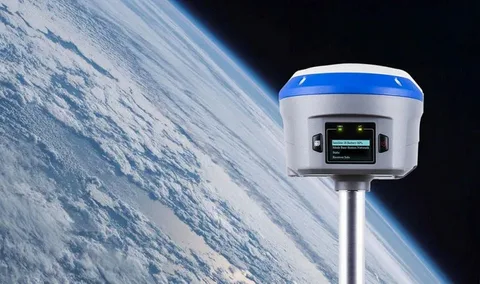
Global Navigation Satellite Systems (GNSS) have revolutionized the way we navigate, communicate, and track movement across the globe. While the U.S.-based Global Positioning System (GPS) is the most widely recognized, several other gnss systems provide similar—and in some cases, enhanced—capabilities. This article focuses on comparing GPS and other GNSS systems worldwide, shedding light on their differences, advantages, and roles in modern technology.
What is GPS?
The Global Positioning System (GPS) is a satellite-based navigation system developed and maintained by the United States Department of Defense. It became fully operational in 1995 and provides geolocation and time information to a GPS receiver anywhere on Earth, as long as there is an unobstructed line of sight to four or more GPS satellites.
GPS is used in everything from smartphones and cars to airplanes and agricultural equipment. It operates using a constellation of 24 main satellites and a few backups, orbiting approximately 20,200 kilometers above the Earth.
What Are Other GNSS Systems?
In addition to GPS, several other countries and regions have developed their own GNSS systems to reduce dependence on a single provider and improve regional navigation accuracy. The most prominent ones include:
1. GLONASS (Russia)
GLONASS (Global Navigation Satellite System) is Russia’s answer to GPS. Operational since 1996, it has a similar number of satellites and provides comparable global coverage. One of its key advantages is improved performance at high latitudes, where GPS signals may be weaker.
2. Galileo (European Union)
The European Union’s Galileo system aims to offer high-precision positioning services with civilian oversight. It is expected to become fully operational with 30 satellites. Galileo often works in tandem with GPS to offer more accurate positioning.
3. BeiDou (China)
China’s BeiDou Navigation Satellite System has rapidly grown into a full-fledged GNSS. BeiDou’s latest iteration, BDS-3, became globally operational in 2020 with a constellation of 35 satellites. It offers unique regional messaging capabilities and strong coverage in Asia-Pacific.
4. Regional Systems
In addition to these global systems, there are also regional systems like:
- QZSS (Japan): Focuses on enhancing GPS accuracy in the Asia-Oceania region.
- NavIC (India): Designed for regional coverage over India and surrounding areas.
Comparing GPS and Other GNSS Systems Worldwide
When comparing GPS and other GNSS systems worldwide, several factors come into play:
Accuracy
While GPS offers excellent accuracy on its own, combining it with other GNSS systems such as Galileo or BeiDou often results in significantly improved location precision—especially in challenging environments like urban canyons or forests.
Coverage and Reliability
No single system has perfect global coverage all the time. Using multiple GNSS systems increases the number of available satellites, enhancing reliability and ensuring better signal availability in poor visibility conditions.
System Ownership and Independence
Depending on the use case, independence from a single-country system is crucial. For instance, the European Union developed Galileo to reduce dependence on U.S.-controlled GPS, especially for critical infrastructure and security.
Innovation and Features
BeiDou’s two-way communication feature allows limited messaging capabilities, which is not available in GPS. Meanwhile, Galileo offers a high-accuracy commercial service that surpasses standard GPS accuracy in some cases.
The Future of Multi-GNSS Use
As GNSS receivers become more advanced, devices increasingly support signals from multiple systems simultaneously. This trend strengthens the case for using a multi-GNSS approach rather than relying solely on GPS.
Comparing GPS and other GNSS systems worldwide is no longer just a technical discussion—it has real-world implications for industries ranging from aviation and shipping to agriculture and emergency services. Multi-GNSS integration is setting the stage for more resilient and precise navigation technologies in the future.
Conclusion
Comparing GPS and other GNSS systems worldwide reveals a complex but exciting landscape of global navigation capabilities. While GPS remains the cornerstone of satellite navigation, the presence of alternative systems like GLONASS, Galileo, and BeiDou offers users more options, better performance, and increased global coverage. As technology advances, the integration of these systems promises to bring even greater accuracy and reliability to navigation solutions around the world.

